


- MLS#: W7619927 ( Land )
- Street Address: Address Not Provided
- Viewed: 219
- Price: $300,000
- Price sqft: $0
- Waterfront: No
- Year Built: Not Available
- Bldg sqft: 0
- Additional Information
- Geolocation: 26.667 / -81.4328
- County: HENDRY
- City: LABELLE
- Zipcode: 33935
- Provided by: RAINBOW INVESTMENT REALTY
- Contact: Lambert Wu
- 954-927-5291

- DMCA Notice
-
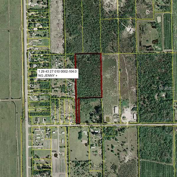
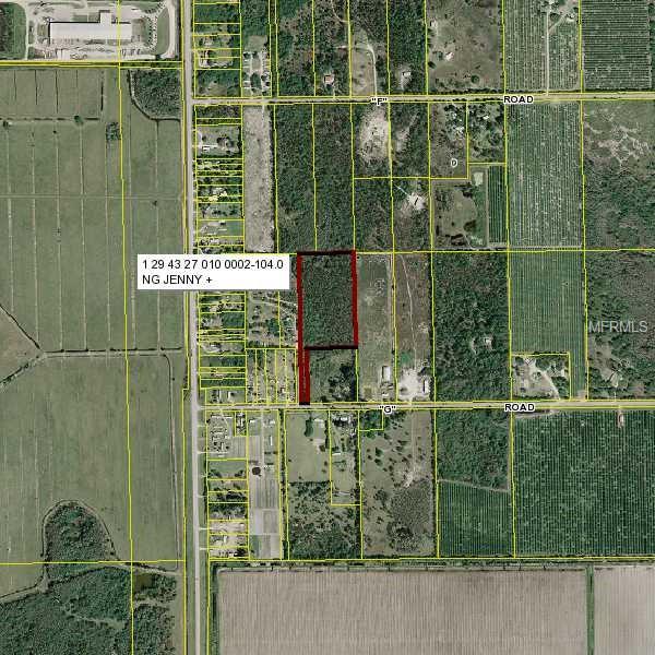
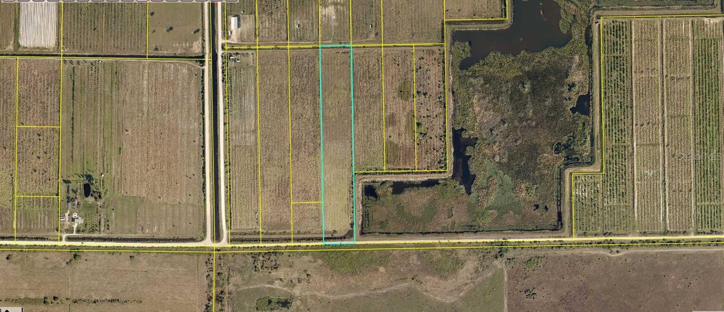
Descriptionvacant land, just less than 10 acress. (9.54 acres). high and dry, trees and untouched land. close to hwy 29, just south of city of Label. for investment or future used. great value. The area are all ready develop with business and family homes. close to the city of Labeel. please check county infomation.
- Principal & Interest -
- Property Tax $
- Home Insurance $
- HOA Fees $
- Monthly -
- Covered Spaces: 0.00
- Living Area: 0.00
- Lot Features: In County
- Garage Spaces: 0.00
- Open Parking Spaces: 0.00
- Carport Spaces: 0.00
- Road Frontage Type: County Road
- Utilities: Cable Available, Electricity Available
- Home Owners Association Fee: 0.00
- Insurance Expense: 0.00
- Net Operating Income: 0.00
- Other Expense: 0.00
- Tax Year: 2021
- Country: US
- Current Use: Residential
- Legal Description: 09-44-29-010-0002-104.0 * LA BELLE RANCHETTES UNREC BEG SW COR SEC 9-N 86 DEG 42 MIN E 568 FT-N 03 DEG 45 MIN W 1324.38 FT-N 86 DEG 38 MIN E 932.5 FT-N 03 DEG 55 MIN 15 SEC W 30 FT TO POB-N 03 DEG 55 MIN 15 SEC W 1295.64 FT-N 86 DEG 34 MIN E 478.5 FT -S 04 DEG 05 MIN 30 SEC E 822.25 FT-S 86 DEG 36 MIN 29 SEC W 430.98 FT-S 03 DEG 55 MIN 15 SEC E 473.85 FT-S 86 DEG 38 MIN W 50 FT TO POB 9.54 AC
- Area Major: 33935 - Labelle
- Parcel Number: 1-29-43-27-010-0002-1040
- Views: 219
- Zoning Code: A-2

Wooded double lot on SR 80 just east of Congen Rd
- Approx. 1.79 acres
- Provided by Illustrated Properties
- Provided through
- DMCA Notice

Address Not Provided Virtual Tour More Like This
Vacant land, Fast growing area. best deal in the area. just less than 10 acres (9.54 acres). High and dry, occupied by tree. Buy it now before the price UP>>> Untouched land for investment or futur
- Approx. 9.53 acres
- Provided by Rainbow Investment Realty Inc
- Provided through
- DMCA Notice

2115 Cr 78 Road Virtual Tour More Like This
...."MOTIVADO SELLER..." This over side lot (4.83 acres) is located at a very select area of Labelle, is cleared, fencing, filling, ready for building, it has a culver, a gate, shade tree and coconut
- Approx. 4.50 acres
- Provided by Xclusive Homes LLC
- Provided through
- DMCA Notice

7081 6th Avenue Virtual Tour More Like This
Excellent opportunity to own 20 acres in the Gerber Groves area of LaBelle, a location well known for agricultural use and large acreage parcels. This vacant land is ideal for farming, grove use, live
- Approx. 20.00 acres
- Provided by EXP Realty LLC
- Provided through
- DMCA Notice
6340 Sears Road More Like This
Per Seller Thriving 10+ Acre Farmstead Ready for Your Vision! Step into a fully operational 10+ acre farmperfectly leveled, richly equipped, and brimming with potential in a vibrant agricultural c
- Approx. 10.14 acres
- Provided by KELLER WILLIAMS ISLAND LIFE REAL ESTATE
- Contact Sean Seward, PA
-
- DMCA Notice

Lot 293 3021 Riverboat Lndg Virtual Tour More Like This
Lot 293 brings the perfect mix of charm and comfort. The mini split AC keeps things breezy year round, and the 16x24 Coach House is full of thoughtful design touches. Wood look floors, crisp white cab
- Provided by Riverbend Realty LLC
- Contact Patty Kulp
- (863) 612-2020
- Provided through
- DMCA Notice

Lot 37 3011 Riverbend Resort Blvd Virtual Tour More Like This
Lot 37 A Luxurious Indoor Outdoor Living Experience at RiverBend Motorcoach Resort. Discover the ultimate blend of sophistication and comfort with Lot 37, a property perfectly crafted for seamless ind
- Provided by Riverbend Realty LLC
- Contact Patty Kulp
- (863) 612-2020
- Provided through
- DMCA Notice

Lot 12 3031 Riverbend Resort Blvd Virtual Tour More Like This
Discover the ultimate waterfront retreat at Lot 12! This serene lakeside lot offers captivating views of two sparkling fountains and a charming walking bridge, creating a peaceful backdrop for relaxin
- Provided by Riverbend Realty LLC
- Contact Patty Kulp
- (863) 612-2020
- Provided through
- DMCA Notice

Lot 219 3041 Belle Of Myers Rd Virtual Tour More Like This
Your Personal Paradise Awaits at RiverBend Motorcoach Resort. Welcome to Lot 219, a one of a kind property that redefines luxury motorcoach living. From the moment you arrive, the eye catching paver d
- Provided by Riverbend Realty LLC
- Contact Patty Kulp
- (863) 612-2020
- Provided through
- DMCA Notice

2115 Cr 78 Rd N More Like This
Motivated Seller and open to negotiation so make an offer. Don't miss the opportunity to own this beautiful 4.83 acres, almost 5 acres, on a paved road, this lot is located in a very select area, is c
- Approx. 4.83 acres
- Provided by Xclusive Homes LLC
- Contact Mirza Quetglas
- 239-228-6242
- DMCA Notice

- Lumi Bianconi
- Tropic Shores Realty
- Mobile: 352.263.5572
- Mobile: 352.263.5572
- lumibianconirealtor@gmail.com